Stevensville, Montana to Grangeville, Idaho
The day of leaving Montana had arrived and I was sad for it doing so. The motorcycle was ready to be picked up at Big Sky, so I headed to Missoula to grab the beast with its new fuel pump. As expensive as it was to replace, I felt good about it as it's one of those parts that fail from sitting and my bike had sat for almost three years before I purchased it.
Big Sky had also found 2 of the 5 studs stripped that hold the pump sealing plate, somewhat common, and since they couldn't guarantee it would seal they'd taken it upon themselves to search for a used gas tank for me in case I wanted. They hadn't found one so they'd stacked washers on the studs for the nut to catch the last few threads. I wasn't too worried and was thankful for their efforts to find another tank.
After the trip up to Missoula for the moto and back, then packing, it was a late afternoon start for Texas. Originally I'd planned to head back south to Idaho through the Bitterroot Valley, but I kept getting suggestions to take Lolo Pass into Idaho because it was a beautiful ride and river valley. My concern was that it would spit me out on the far western edge of Idaho and I'd have to loop back east to the Moab, Utah area. There are no roads in the central region of Idaho, only rugged mountain terrain.
At the last moment I decided to go ahead and ride Lolo Pass, based on the fact it might be a long time before I ever got back to this area and it was in close proximity at the moment.

The Bitterroot Valley was shrouded in smoke and haze from multiple forest fires as I rolled north from Stevensville. I could barely make out the mountains through the haze as I rode through the heat and turned onto Hwy 12 for Lolo Pass. I have to admit the heat had been oppressive in Montana and my fantasies of escaping from a Texas summer to a cooler climate had been squashed. However, I'd had a blast, getting to have a few adventures and a lot of fun in the process.

Lolo Pass was beautiful as I swept through the turns early on. I'd been warned of the moose in the area and had heard on the news a rider had just been killed by a moose on Lolo Pass a couple of days before I left. When I'd picked up the motorcycle, someone at the dealership warned me to watch for moose, as not one but two riders had been killed by moose in a two week period.
Each blind corner of the twisty road brought a beautiful view and also a sense of concern, knowing the narrow road could instantly be filled with a deer or moose from the brush at the sides. I entered one blind curve, only to see in the midst of it, scraped asphalt and skid marks from both directions, a large stain of oil and two large stains, surrounded by orange spray painted investigation marks outlining the path of the crash. I can only assume it was where the rider had just been killed by a moose.
As I rounded another bend, a large helicopter came lifting out of the river with a huge water pouch beneath it, dripping as it flew away to attack a fire somewhere nearby, the mist and spray of the water hitting me as it went overhead.
The pass is truly a beautiful road, but also one that keeps you on your toes. It's filled with blind corners and no shoulder, so you stay busy and alert. Each corner seemed to be a challenge this day, with a huge tandem trailer coming around the curve halfway in my lane - each of us passing only an arms length apart.
These guys are not your friends...

The road had a fair amount of traffic with winds high and gusty. The loaded bike kept me busy with the log trucks adding waves of turbulence to the wind gusts. In addition, road crews had been dumping asphalt on the inside of corners and about every 5th turn I'd suddenly find myself on loose gravel.
Huge thunderheads were building and by the time I reached the community of Lowell it had gotten very dark in the middle of the afternoon. I stopped and put on my rain gear, timing it perfectly as the rain hit as soon as I got back on the road.
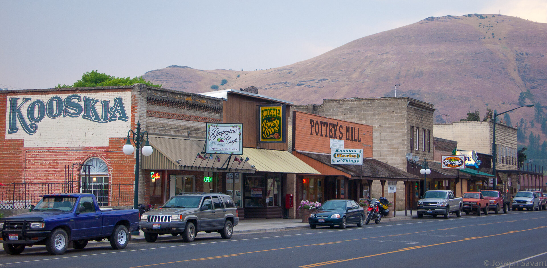
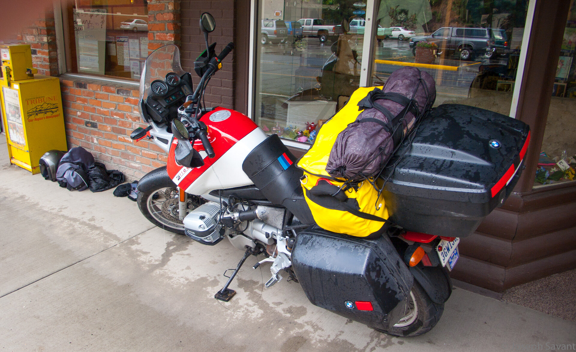
It rained steadily all the way to Kooskia where it finally stopped, as did I. Parking the bike against the curb, I meticulously laid out my gear on the seats to dry, then grabbed a cup of coffee in the cafe. Of course, as i sat watching, a sudden massive downburst of rain suddenly hit without warning and I ran out to try and grab my gear. It was too late, as it was soaked and I was as well. I went ahead and got the bike and gear up on the curb and under an overhang. Sopping wet and dripping water, I carried my soaked gear into the bathroom, undressed and wrung out as much water as possible in the bathroom before returning to finish my coffee.
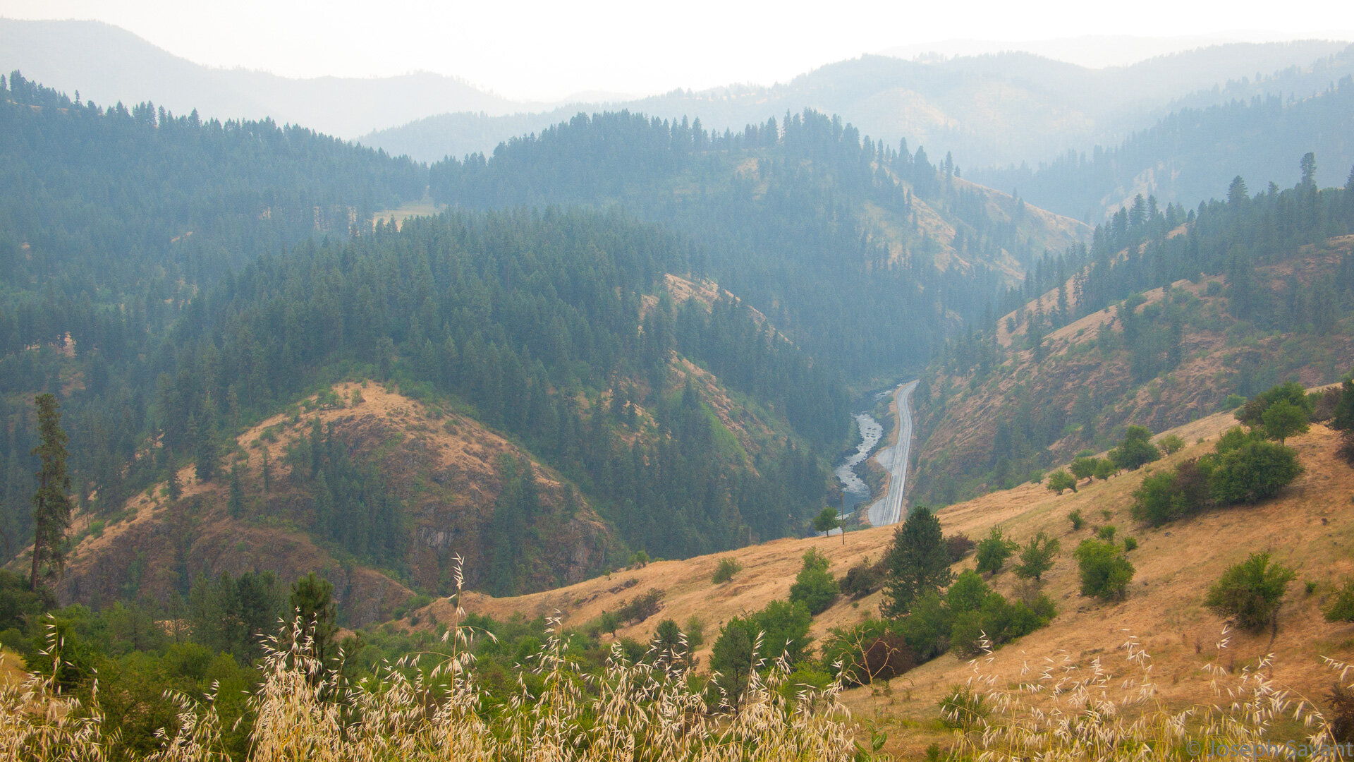
Eventually the rain slacked off and I slipped back into my wet gear, heading south on 13 towards Grangeville. The rain returned in sheets and I could tell Hwy 13 was a gorgeous ride, but in the rain and fogged visor I couldn't see much. A few miles out of Grangeville the rain became sporadic, but thick fog came rolling in, covering the high switchback areas as I climbed out of the canyons onto a plateau.

I finally hit sunshine to warm my soaked Levi's as I cleared the mountains and approached Grangeville.

Ragged from the rain, the ride and the late start, I decided to spend the night in Grangeville. By the time I got checked in and my gear drying, it was about 15 til 9 pm and I rode downtown to get a bite to eat. All the restaurants closed at 9, however one let me in just a minute or two before 9, much to the chagrin of the teenage waitresses who were anxious to go home.
The manager, Kathy, ran her mother's place, Barb's Cafe, and she rode herd on the teen girls. We chatted a long time while they made me an outstanding BLT with fries. She discussed the heat wave and the best route to Boise, as well as some other great riding areas around the region.
It was a nice gesture to keep her place open for me, and one I was highly grateful for.
The Route:

South for Twin Falls, Idaho
The next morning was sunny and hot. I left Grangeville on Hwy 95 south towards Boise. My lovely Idaho mountains and river valleys had now become flat plains covered with crops from horizon to horizon, still bathed in the smoke of distant forest fires.
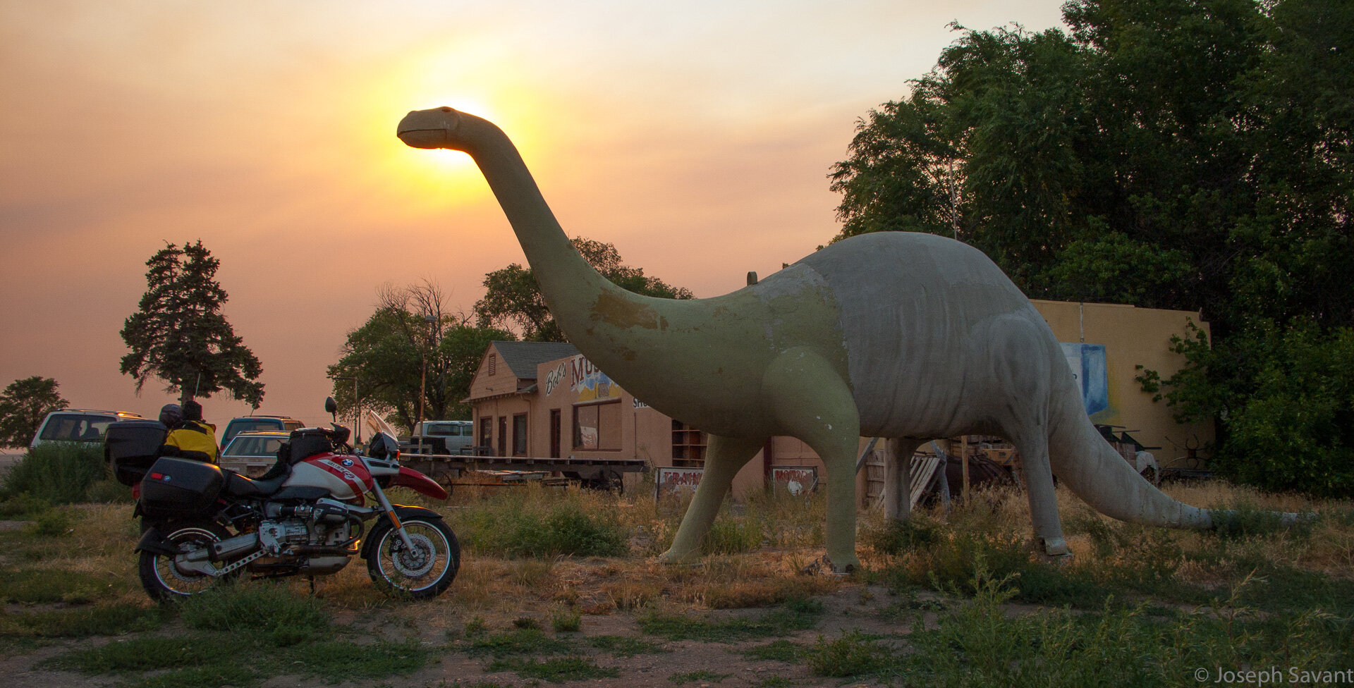
A couple of miles out of town, I saw an official state sign for a “Woolly Mammoth Discovery Site” and turned off onto gravel roads in search of the place

I guess the state decided not to put a sign at the site because I never found it and ended up looping back to 95 after a 7 mile long detour.

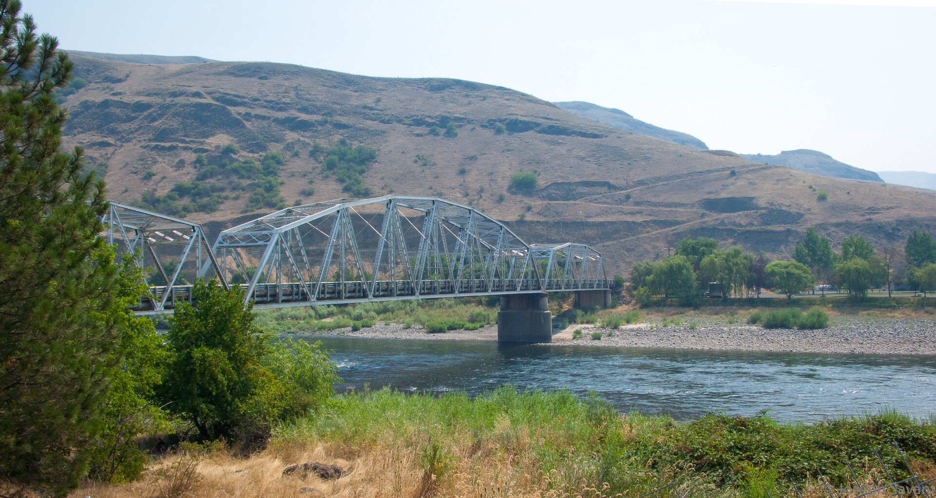
It wasn't too long before the flat plains disappeared and the road became much more interesting, with rolling hills and valleys. The smoke of many forest fires obscured the stunning views, but it still was a great ride. Highly suggested route!

I raced on due south to White Bird and saw signs for an Indian war battlefield. There was some fabulous scenery on this ride and I was wishing for clear skies so I could really appreciate it, however I'd come to understand that this was a normal occurrence in these states. I detoured to the battlefield on some side roads.


Battlefield where the Nez Perce tribe defeated the U.S. Cavalry

White Bird community

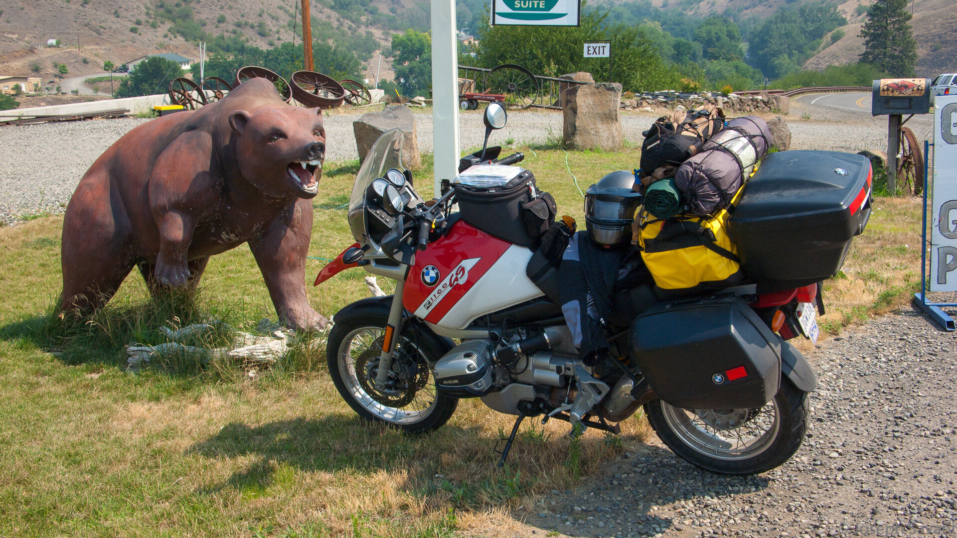
Stopping for a Coke at the local souvenir shop, the Pig was viciously attacked by a fiberglass grizzly.
The twisty road took me through a few small towns and finally Riggins, where there were a lot of river rafting companies. It looked like a cool place to stay the night. Next time.

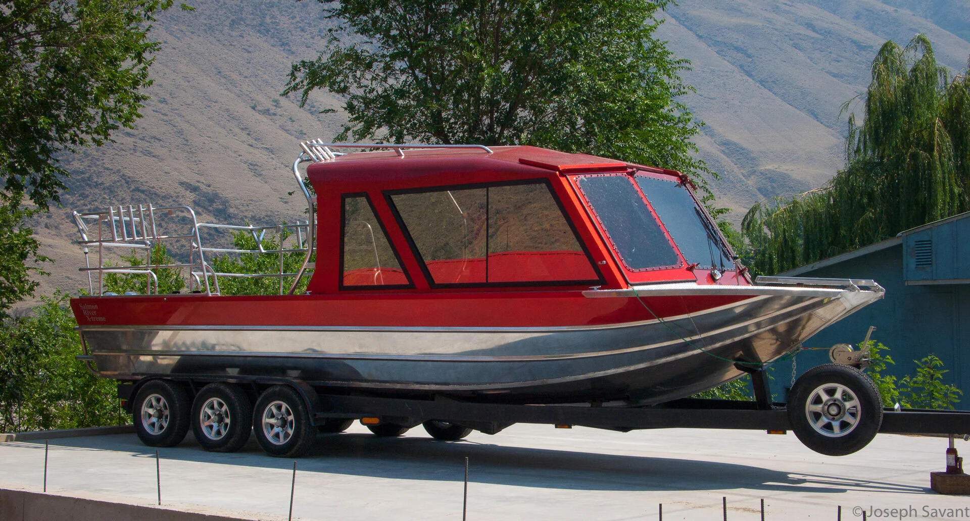
A bad to da bone river boat
Idaho and its rugged landscape are known to contain some "independent" folks. I now call this road "Route 666"

More road construction

I finally reached the junction of highways 55 and 95 at New Meadows and pulled in to top off the tank. To the side I saw an old blue BMW parked under a tree with the rider sitting at a picnic table. I pulled over and introduced myself. "Rouch" shook hands and we started talking bikes. He lived in the area and was in New Meadows checking out an old Harley panhead for a friend. Rouch had recently bought the 1974 R900 with 80,000 miles on it. He'd mainly ridden Harley panheads previous to the Beemer, but was enjoying the bike and planned to take it on a ride from Idaho through Canada and down to New York City in the late summer.
Rouch and his 74 R900

He suggested some rides and also that I continue on 95 instead of 55. A waitress had suggested 55 to Boise but Rouch said it was congested with trucks and construction and 95 would be a better ride. I finally let him get back to his half eaten hamburger and headed south on 95.
Hwy 95 was pretty and it too had road construction in spots, but overall was a great road. Eventually it played out into flat open landscape, sweltering in the heat. At the junction of 95 and I-84 in Payette there was a great surplus and military vehicle sales lot. Military trucks, Humvees, Huey choppers and even Abrams tanks were for sale. Man toys for sure.

How in God's name do you dent an Abrams tank?

I was very near the border of Oregon, so I detoured west across the Snake River to Ontario, Oregon just so I could say I'd been, then looped back over the river on I-84 for Boise. The highway had just recently been prepped for a new blacktop layer, so it was about 15 miles on slick, fresh nasty tar.
The ride was flat, hot and boring, with long stretches of 45 mph single lane road while the highway was being reworked.
When I FINALLY reached Boise and found Big Twin BMW for a breather and a T-shirt, I spotted two suspicious and gnarly looking guys hanging around a somewhat dirty R1200GS. My instincts were correct and sure enough they were adventure riders who frequented the forums at ADVRider.com. The 1200GS belonged to "Bonebag", and "Nortwoods" was on a 2000 Triumph Tiger. Nortwoods was one big dude, 6'9" and made the Tiger look like a kid's bike. They were getting new rear tires put on and heading for northern California. They'd ridden from Twin Falls and informed me it was flat, hot and boring. As I was leaving, another rider pulled up on a 1998 R1100GS and we talked a bit. He suggested I take Hwy 30 to Twin Falls instead of I-84 for a change of scenery.

Bonebag and Nortwoods

Bonebag was a photographer and was courteous to take a couple of shots of yours truly. Thanks Bonebag!


Bonebag and Nort were right on. It was "flat, hot and boring". I motored on as fast as possible in the hot, high and gusty winds until the exit for Hwy 30 at Bliss appeared - the "Thousand Springs Byway".

Hwy 30 certainly was nicer than the interstate and followed the river through valleys and fossil beds. I had run out of water in the Camelbak earlier and finally got so dehydrated I had to stop. I sucked down a frozen drink and liter of water as it began to get dark, the orange glow of the skies beautiful and acrid from the forest fires.

A side road to the river

I reached Twin Falls at dusk and found a decent hotel for the night.
Today's Route:
